RSS

Three Towers Approved at Commercial-Broadway: 1,000+ New Rentals to Rise Above Former Safeway Site

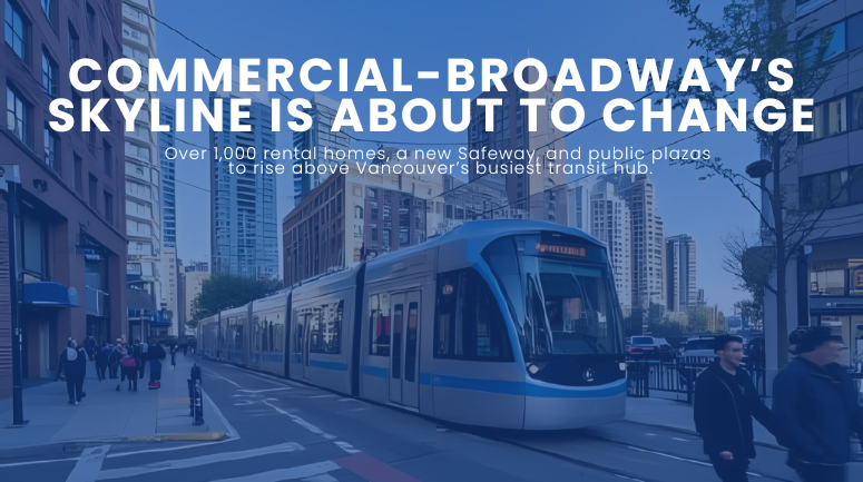
A massive redevelopment plan years in the making has officially cleared its final hurdle. On June 10, Vancouver City Council approved a bold new vision for 1780 East Broadway—home to the aging Commercial-Broadway Safeway and its sprawling surface lot. The future? A trio of high-rise rental towers bringing over 1,000 new homes, new public plazas, and an expanded Safeway to one of the busiest transit hubs in the region.

Transit-Linked Density: What’s Coming to 1780 East Broadway

The approved project, led by Westbank Corp. and Crombie REIT, will deliver three residential towers—rising 37, 38, and 44 storeys—right beside the Commercial-Broadway SkyTrain Station. In total, the development will add 1,044 new rental homes to Vancouver’s tight housing market. Of those, 104 units will be offered at city-wide average market rents, while the remaining 940 will rent at full market rates.

The plan also includes:

  • A larger, modernized Safeway supermarket

  • 24,000 square feet of additional retail space

  • A 32,000-square-foot public realm including a ground-level plaza and a 12,000-square-foot upper courtyard

  • A 37-space childcare centre to be gifted to the city

This high-density, transit-oriented development (TOD) will boast a floor space ratio of 8.3 and tower heights reaching up to 146 metres—far beyond what was originally envisioned in the Grandview-Woodland Community Plan.

A Decade in the Making: A Contested Path to Approval

The road to approval wasn’t smooth. The proposal, in various forms, has been circulating for nearly 10 years, weathering multiple redesigns, political shifts, and extensive public scrutiny. Earlier iterations leaned more heavily on condo units and lower towers. But the final version—entirely rental—emerged stronger in height and housing count following revisions and the city’s growing urgency to address its housing crisis.

Despite two lengthy public hearings and hundreds of written submissions, Council passed the rezoning with a decisive 8–1 vote. Only COPE Councillor Sean Orr opposed, while Councillor Pete Fry abstained.

Supporters on council argued the site is precisely where high-density housing belongs: next to the city’s third-busiest transit interchange. Mayor Ken Sim highlighted that the site replaces only a parking lot and supermarket, involves zero residential displacement, and will boost local businesses through increased foot traffic.

“This project ticks a lot of boxes,” Sim said during deliberations.

Opposition, Trade-Offs, and the Affordability Question

Not everyone is convinced. Of the roughly 100 speakers at public hearings, the majority opposed the plan—largely due to its scale and affordability shortcomings. Critics pointed to a “doubling” of allowable height with only 10% of units offered at below-market rents—far short of the Broadway Plan’s guideline of 20% at deeper affordability levels.

Councillor Fry voiced concern that the city’s commitment to public benefits and meaningful affordability was slipping in favor of developer economics. Councillor Orr echoed this sentiment, calling the development “precedent-setting” in its compromises.

Still, other councillors, like Rebecca Bligh and Sarah Kirby-Yung, emphasized the need for progress.

“We’ve had a high-speed transit line here for years and no density to match it,” Bligh remarked, calling the current underuse of the site “misleading.”

Why This Matters for Vancouver Home Seekers

This redevelopment marks a major shift in how Vancouver is choosing to build its future—particularly along its busiest transit corridors. It reflects a city pivoting from slower, low-density processes toward larger, rental-focused projects that meet the moment of its housing crisis.

For renters and newcomers to the Grandview-Woodland area, it signals that more housing is coming—even if affordability remains a thorny issue. For longtime residents, it raises ongoing questions about how growth is balanced with neighborhood character, sunlight, and green space.

Construction timelines have not been finalized, as ground-breaking will depend on market conditions. But with approval now secured, the site’s transformation is no longer a matter of if—but when.

Curious how this will reshape Grandview-Woodland’s skyline—and its streetscape? We’re keeping a close watch on projects like this to help our clients stay ahead of the curve. Want to be one of them?

Read

New Elementary School Coming to Olympic Village by 2029: A Long-Awaited Boost for Vancouver Families

A long-anticipated public elementary school is finally coming to Vancouver’s Olympic Village, bringing major relief to overburdened schools and growing families in one of the city's fastest-developing neighborhoods. Backed by more than $150 million in provincial funding and built on city-donated land, the new school is set to open as early as 2029 and will offer 630 student spaces for Grades K–7.


A Community Milestone in the Making

Slated for 215 West 1st Avenue—steps from False Creek and nestled beside Hinge Park—the new four-storey Olympic Village Elementary will be the first school built in the neighborhood since the area’s transformation from industrial lands to a vibrant residential and commercial hub. Long a priority for the Vancouver School Board (VSB), the project was greenlit after the B.C. government approved its massive funding request in April 2024.

With rezoning now underway and construction targeted to begin by 2027, this project will reshape the educational landscape of Southeast False Creek.


Designed for Modern Learning and Community Life

Olympic Village Elementary is more than just a school—it’s designed as a cornerstone of community life. In addition to classrooms, the 64,583-square-foot building will feature:

  • A neighbourhood learning centre with dedicated child care space

  • A rooftop play and learning area, bringing innovation and activity into a vertical space

  • Facilities for community engagement, aligning with the city’s “complete community” vision

  • Seismic safety and accessibility, built to modern standards for peace of mind

While its proposed height of 62 feet slightly exceeds existing zoning bylaws, this change is crucial to house the 630 students the community demands—particularly on a site constrained by size.


Why Olympic Village Needs This School Now

Since Olympic Village was established as part of the 2010 Games legacy, the neighborhood has blossomed into one of Vancouver’s most desirable places to live. But with the influx of families has come intense pressure on nearby schools. Simon Fraser Elementary, built in 1958 for just 182 students, currently operates at nearly 190% over capacity.

This new school directly addresses that strain, providing a long-term solution to chronic overcrowding. Nearby schools—such as Edith Cavell, False Creek, and Crosstown Elementary—have also been shouldering the overflow, impacting families throughout Mount Pleasant, Cambie, and downtown.

The project promises to keep families rooted in the area they love, removing the pressure to relocate for better school access.


Years in the Making: A History of Planning and Patience

The seeds for this school were planted almost two decades ago. The need was formally identified by the VSB in 2005, and by 2007 the City of Vancouver had reserved the site during its Southeast False Creek development planning.

Progress, however, was slow. It wasn’t until 2022 that the City and VSB finalized a 99-year ground lease for the parcel. With funding finally secured in 2024, the project is now in the public engagement phase of the rezoning process.


A Broader Investment in Vancouver's Future

The Olympic Village school is part of a sweeping provincial commitment to upgrade education infrastructure across British Columbia. Since 2017, the Province has invested over $4 billion in schools, with $3.75 billion more earmarked through 2027. In Vancouver alone, more than $526 million has been directed to new and expanded school projects.

Local examples include the expansion of Henry Hudson Elementary, adding 145 student spaces by 2025, and seismic upgrades at Edith Cavell and David Livingstone Elementary.


A School to Anchor the Neighborhood

Community leaders say this school is more than bricks and mortar—it’s a symbol of stability, belonging, and progress.

“This new school site will become the beating heart of Olympic Village,” said Vancouver Mayor Ken Sim.

“We’re not just building classrooms—we’re building community,” added Brenda Bailey, MLA for Vancouver-False Creek.

The Vancouver School Board also notes the school will serve as a community hub, reinforcing connections between families, educators, and the broader neighborhood.


Looking Ahead

If approvals proceed smoothly in 2025–2026, shovels could hit the ground in 2027, with a grand opening by 2029—or possibly 2030 if delayed. Either way, the finish line is in sight for a project two decades in the making.

Curious how this could shape the future of Olympic Village? We’re keeping a close eye on projects like this so our clients always stay informed. Want to be one of them?

Read

Vancouver Greenlights Ambitious Rupert and Renfrew Station Area Plan to Guide 30 Years of Growth

The City of Vancouver has officially approved the Rupert and Renfrew Station Area Plan—an ambitious blueprint poised to transform East Vancouver’s SkyTrain corridor into a vibrant, connected, and climate-resilient hub over the next 30 years. Unanimously endorsed by City Council on July 8, 2025, this long-anticipated plan sets the stage for thousands of new homes, jobs, and public amenities between Rupert and Renfrew SkyTrain stations.

A Transit-Oriented Vision for Inclusive Growth

Spanning approximately 1,631 acres from Parker Street in the north to E 27th Avenue in the south, the Rupert and Renfrew Station Area Plan outlines a bold vision: to create a neighbourhood rich in housing options, economic opportunity, green space, and cultural vitality. It emphasizes equity, sustainability, and Indigenous reconciliation—all grounded in strong community engagement.

Originally launched in late 2021, the plan supports the Vancouver Plan’s (2022) city-wide strategy for future growth. But here, the focus sharpens to meet local needs—like restoring Still Creek’s ecosystem, addressing housing affordability, and ensuring development aligns with transit access.

45-Storey Towers and “Missing Middle” Housing

At the heart of the plan is a four-pronged land use strategy designed to balance density, livability, and employment growth:

  • Rapid Transit Areas near the SkyTrain stations will accommodate the highest towers—up to 45 storeys—exceeding provincial minimums under Bill 47. These zones prioritize below-market rental housing and childcare in return for increased height and density. Retail, hotels, and improved transit links are also planned.

  • Village Areas, currently a mix of local shops and low-rise homes, will grow with six-storey buildings and multiplexes—introducing the kind of “missing middle” housing that Vancouver urgently needs.

  • Multiplex Zones further from transit retain R1-1 zoning but now allow up to six strata or eight rental units per lot, plus small corner stores via private rezoning.

  • Employment Lands—home to industrial and commercial space—will be preserved and intensified. From big-box retail and film studios in Still Creek to 30-storey mixed-use towers near transit, these areas are key to job creation. The notable exception? The 3200 E Broadway site, a 10-acre mixed-use residential development led by the Musqueam, Squamish, and Tsleil-Waututh Nations in partnership with Aquilini Development.

Across all zones, new developments must consider Still Creek’s sensitive floodplain and groundwater dynamics—factors that informed site-specific density allowances and parking restrictions.

Welcoming 18,700 New Residents—and 8,300 Jobs

If fully implemented, the plan could deliver:

  • 10,100 new homes,

  • 8,300 new jobs,

  • And housing for 18,700 additional residents over the next 25 years.

This marks a significant step toward addressing the city’s housing crisis while bolstering its economic base. To ensure equitable development, the City will enforce strong tenant protections and prioritize below-market housing wherever feasible.

Community Roots and Engagement

Rich in cultural history and social infrastructure, the Rupert-Renfrew corridor has long been home to diverse communities and Indigenous presence. Over 70% of its 31,000 residents identify as visible minorities—well above the city average.

Recognizing this, the planning process included deep and multilingual outreach, including 72 engagement events, 2,100+ survey responses, and materials in Chinese, Tagalog, and Vietnamese. Indigenous nations were closely involved throughout all four engagement phases, culminating in feedback-driven refinements earlier this year.

$1.2 Billion in Capital Investments

Realizing this vision will require an estimated $1.2 billion in capital and in-kind investments over the next decade. From new parks and childcare centres to transportation upgrades, these investments are critical to support the area’s anticipated population and job growth.

To help fund this, Vancouver will amend its Community Amenity Contributions (CAC) policy for the area. Market rental projects with childcare or below-market units will be exempt, while strata developers will follow newly set CAC targets—subject to review in 2026.

Additional measures include new design guidelines, streamlined rezoning processes (especially in low-rise and village areas), and repeals of outdated local plans.

A Model for Future Growth in Vancouver

With its mix of high-density towers, expanded job zones, and creekside ecological restoration, the Rupert and Renfrew Station Area Plan reflects a new era of planning in Vancouver—one rooted in equity, climate resilience, and livability.

It also offers a preview of how other neighbourhoods might evolve in response to the Vancouver Plan’s city-wide goals. For longtime residents and future homebuyers alike, the area is set to become a dynamic and desirable place to live, work, and grow.

Curious how this could shape the future of East Vancouver? We’re keeping a close eye on projects like this so our clients always stay informed. Want to be one of them?

Read

New Neighbourhood Green Space Coming to Kitsilano–Fairview Border: Burrard Slopes Park Takes Shape

The Vancouver Park Board is transforming a one-hectare patch of city land into a lush and inclusive community park at the border of Kitsilano and Fairview. Temporarily dubbed Burrard Slopes Park, this long-anticipated green space will rise between Pine and Fir streets and West 5th and 6th avenues—serving as a much-needed urban oasis for thousands of nearby residents.

A New Vision for an Industrial Past

What is currently a mix of vacant buildings, temporary parks, and a stretch of the Arbutus Greenway is being cleared to make way for a thoughtfully designed public park. The existing structures—once part of the area's industrial character—are being removed, with demolition work expected to wrap up between spring 2024 and mid-2025. In line with Vancouver’s Green Demolition by-law and Zero Waste 2040 goals, many of the materials are being reused where possible, including historic timber trusses that will be integrated into the park’s final design.

During this transitional period, the city has planted a temporary wildflower meadow to aid in soil remediation and create an interim natural buffer until full-scale construction begins—expected around 2027.

What the Community Asked For—and Will Get

The project has been shaped by robust community engagement. Over 875 survey respondents and more than 100 attendees at an in-person event helped shape the park's guiding vision: a place that is welcoming, safe, accessible, and ecologically vibrant. Community members emphasized the need for green space, areas for relaxation and socializing, and amenities for all ages and abilities.

Key features of the draft concept plan include:

  • A plaza-style skatepark in the northwest corner, designed for all skill levels and “all wheels,” bordered by planted hills to buffer noise.

  • An expanded and inclusive playground, offering accessible elements such as a bucket spinner, rope nest swing, and wheeling circuits, with two design options currently under consideration.

  • A dog off-leash area (OLA) with natural materials like timber and boulders, combined with comfortable seating for pet owners.

  • Layered gardens throughout—pollinator gardens, rain gardens, community plots, and peripheral native planting—to enhance biodiversity, manage rainwater, and provide beauty and calm.

  • A central lawn and social seating spaces, including curved benches, picnic tables, and a large “harvest table” for gatherings.

The park also aligns with multiple City of Vancouver strategies, including VanPlay, the Biodiversity Strategy, and the People, Parks and Dogs policy. It builds on connectivity with nearby amenities such as the Arbutus Greenway, the Granville Bridge Greenway, and aligns with the larger Broadway Plan.

Welcoming the Future, Rooted in the Past

One of the park’s most compelling features is its respectful nod to the site's industrial legacy. The design includes repurposed materials from buildings once used by contractors like Bennett and White. These pieces are being reimagined as park structures, tying past and future together in a space designed for gathering, play, and rest.

Land acknowledgments also form a meaningful foundation. The site sits on the unceded traditional territories of the xʷməθkʷəy̓əm (Musqueam), Sḵwx̱wú7mesh (Squamish), and səlilwətaɬ (Tsleil-Waututh) Nations, and the park’s creation is guided by the city’s Reconciliation goals and its commitment to inclusion and accessibility.

What’s Next for Burrard Slopes Park?

With the second round of public engagement wrapped up as of April 2025, the project team is now analyzing feedback and refining the concept plan. By fall 2025, the final park design will be revealed and presented to the Park Board. If approved, detailed design and permitting work will begin—setting the stage for construction to break ground in 2027.

Curious how this green oasis will reshape the Kits–Fairview area? We’re closely following the Burrard Slopes Park project to keep local homeowners and buyers informed every step of the way. Want to be one of them?

Read

Vancouver’s Chinatown Memorial Square Redesign Moves Forward With Community Vision at Heart

A long-awaited transformation of a key public space in Vancouver’s Chinatown is taking shape, as the Memorial Square Redesign project advances with strong community input and cultural intention.

Located at the historic intersection of Keefer and Columbia Streets, Chinatown Memorial Square is being reimagined to better honor Chinese Canadian heritage, improve public space infrastructure, and revitalize one of Vancouver’s most symbolic urban gathering places. With deep roots in the city’s multicultural legacy and a vision shaped by residents, the redesign is set to play a central role in the ongoing transformation of Chinatown.


Honouring Legacy While Looking Ahead

The Memorial Square Redesign project was born from the 2018 Historical Discrimination Against Chinese People in Vancouver report, a landmark moment that acknowledged past injustices and set the tone for reconciliation and cultural preservation. In alignment with broader initiatives like the Chinatown Transformation work and the North East False Creek Plan, the redesign aims to strengthen Chinatown’s historic character while preparing it for a vibrant future — one that could eventually earn UNESCO World Heritage Site recognition.

Anchoring the square’s importance are nearby cultural assets like the Chinese Cultural Centre, Dr. Sun Yat-Sen Classical Chinese Garden, and the Chinese Canadian Military Museum. The square, established in 1995, already serves as a setting for key community events, cultural festivals, and moments of remembrance. But decades later, its infrastructure and design are ready for renewal.

*Photo by City of Vancouver


A Community-Driven Vision for the Square

Through multiple phases of community engagement between 2021 and 2025, a clear vision has emerged. The square will be a welcoming, inclusive, and vibrant space where the legacy of Chinese Canadians — including railway workers, veterans, and community builders — is visibly and respectfully commemorated. The draft vision calls for a space where year-round traditions, intergenerational exchange, and cultural celebration can thrive, all while offering an inspirational experience to visitors and locals alike.

Surveys show strong support: 69% of respondents agreed with the draft vision, while 70% supported the outlined goals. Among the top priorities were making the square accessible and culturally meaningful to Chinese seniors, enhancing safety, offering educational opportunities, and providing amenities for festivals and daily use.

*Photo by City of Vancouver


Community-Led Ideas, Design, and Expansion

A 14-member Community Advisory Group (CAG), representing longstanding Chinatown organizations and stakeholders, has played a central role in advising the project team. From the Chinese Benevolent Association to youth collectives and the Chinese Canadian Military Museum Society, the group has helped guide design priorities that reflect both tradition and present-day community needs.

Among the most popular ideas has been expanding the square’s footprint. Community members showed 78% support for a proposal to close the adjacent lane, reduce road widths, and shift curbs — a move that would increase the square’s usable space and reduce traffic impacts while improving pedestrian safety.

Residents also emphasized incorporating flexible infrastructure to support cultural programming, art installations, performances, and markets — all features that reinforce the square as a “living” space. Aesthetic upgrades like lighting, greenery, shade structures, and water features were also high on the wish list.


Addressing Concerns and Future Considerations

While feedback has been overwhelmingly supportive, concerns remain. Community members highlighted ongoing issues like maintenance, cleanliness, and safety — especially given the square’s proximity to the Downtown Eastside. Others called for greater acknowledgment of the unceded Indigenous lands the square occupies and better integration of Indigenous presence and storytelling.

Respondents also asked for amenities such as public washrooms, seating for elders, and low-cost parking. There’s strong interest in ensuring the site is not just beautiful but also practical, inclusive, and active throughout the year.


What’s Next for Memorial Square?

The project is currently in its third phase, with the City having recently closed feedback on three preliminary design concepts. Following this, a preferred design will be refined and presented to the public in fall 2025. The City has committed to ensuring the final design reflects the voices and values of the Chinatown community while also creating a destination space that resonates across cultures and generations.

As Vancouver’s Chinatown continues its journey toward revitalization and potential global recognition, Memorial Square is poised to become not just a physical centerpiece, but a symbol of resilience, cultural pride, and community-led progress.


Curious how this could shape the future of Vancouver’s Chinatown? We’re keeping a close eye on projects like this so our clients always stay informed. Want to be one of them?

Read

Granville Street’s Big Comeback: Vancouver Sets Bold 20-Year Vision for Downtown Entertainment Hub

Downtown Vancouver’s iconic Granville Street is on the cusp of a major transformation. Through the ambitious Granville Street Planning Program, the City of Vancouver is laying the groundwork for a revitalized future that honours the area’s historic character while addressing long-standing challenges and creating space for inclusive cultural growth. A final plan is expected to go before City Council in June 2025, charting a 20-year path to reshape the beloved, yet beleaguered, entertainment corridor.

A Vision to Reinvent Granville Street

Spanning Granville Street from Drake to Robson—an area historically rich in nightlife, neon, and cultural landmarks—the plan aims to re-establish this stretch as an exciting, safe, and inclusive downtown destination. Drawing from public input and informed by reconciliation goals, economic needs, and community priorities, the City’s vision integrates land use changes, transportation shifts, and bold public space strategies.

At its heart, the plan is about balance: blending heritage with modern vibrancy, boosting both daytime and nighttime activity, and ensuring the street is welcoming for everyone—residents, businesses, tourists, and the host Nations whose unceded territories form the foundation of this space.

What’s Coming: Key Moves and Sub-Areas

Granville’s future will unfold through five major “key moves”:

  1. Entertainment District Management – Coordinating safety, public realm upgrades, and ongoing management for a better street experience.

  2. Arts, Culture & Entertainment – Reinforcing Granville’s role as a cultural beacon with more live music, public art, and all-ages performance spaces.

  3. Land Use & Development – Encouraging diverse new developments, heritage preservation, and increased commercial activity.

  4. Public Space Improvements – Introducing a signature pedestrian-only zone, with flexible public space for events, patios, and gatherings.

  5. Transportation Realignment – Rerouting buses to Howe and Seymour streets to make room for pedestrian-first design on Granville.

The corridor will be divided into three sub-areas, each with a distinct focus:

  • City Centre (Granville & Robson): Envisioned as a civic heart anchored by a new public plaza. SkyTrain access will be highlighted, new towers may rise, and the intersection will feature a digital art landmark akin to a mini Times Square.

  • Entertainment Core (Smithe to Davie): A vibrant hub for nightlife and cultural venues like the Orpheum and Commodore. Outdoor performance space, patio culture, and heritage neon will define the experience. Notably, no new housing will be added here to preserve the district’s character and mitigate noise conflicts.

  • Bridgehead (near Granville Bridge): A quieter, mixed-use area connecting Granville to Yaletown and South Granville. Emphasis will be on local shops, social buildings (combining housing and other uses), and intimate public spaces.

Pedestrian-First Future

One of the plan’s most striking features is the proposed year-round pedestrian zone running from Granville Bridge to Waterfront Station. In the short term, this will begin with seasonal closures during summer months—transforming the street into a people-centric promenade filled with patios, street performers, and community events.

To accommodate transit needs, buses will be shifted to Howe and Seymour streets, with significant upgrades like bus-only lanes, wider sidewalks, better shelters, and improved wayfinding. These changes are essential to maintain transit reliability while freeing up Granville Street for public life.

Reviving Culture, Reclaiming Public Space

Granville’s legacy as Vancouver’s entertainment district is central to the plan. From vaudeville to rock concerts, the street has always had a soundtrack—and now the City wants to turn up the volume. The strategy calls for protecting existing venues, incentivizing new cultural spaces, and supporting Indigenous-led public art and self-determined cultural spaces.

Public safety and cleanliness are top priorities. The plan includes gender-based safety initiatives, more accessible public washrooms, and collaborative street outreach efforts—particularly in addressing the needs of people experiencing homelessness.

A major cultural touchpoint will be the new video screen zone at Granville and Robson. This area will serve as a visual and social landmark, hosting art installations and performances while generating revenue for cultural programming through ad partnerships.

Development with Purpose

With updated zoning and design guidelines, new developments will be encouraged—but not at the expense of the area’s soul. Heritage preservation, building articulation, and the classic “sawtooth” storefront pattern will be reinforced. New developments must meet high acoustic standards, particularly near nightlife zones, and contribute to broader public benefits such as affordable housing, job space, and cultural amenities.

Importantly, interim policies are in place to prevent speculative development and ensure that new projects align with long-term community priorities.

Public Input and Path Forward

Thousands of Vancouverites have weighed in during the multi-phase engagement process, with strong support emerging for the plan’s cultural vision, pedestrian-first approach, and mixed-use revitalization. Safety and transit access remain concerns—but the City is working closely with community groups, businesses, and the public to fine-tune the final draft before Council consideration in June.

A 20-Year Commitment to Change

The Granville Street Planning Program isn’t a quick fix—it’s a layered, forward-thinking roadmap to restore one of Vancouver’s most recognizable corridors. If successful, it will blend old and new, day and night, movement and gathering—recasting Granville as not just a place to go out, but a place to belong.

Curious how this could shape the future of downtown Vancouver? We’re keeping a close eye on projects like this so our clients always stay informed. Want to be one of them?

Read

Major Transportation Upgrades Coming to Kits Point Ahead of Sen̓áḵw Development

Vancouver's Kits Point neighbourhood is set to undergo significant transportation upgrades as the City prepares for the transformative Sen̓áḵw development. Designed to improve safety and connectivity for people walking, biking, and rolling, these changes aim to support future population growth while preserving neighbourhood livability.


A New Era for Kits Point Mobility

The Kits Point area is about to become a model for multimodal urban design. In response to the upcoming Sen̓áḵw development — a landmark, car-lite, rental-focused project by the Squamish Nation — the City of Vancouver is rolling out a phased package of street upgrades that prioritize active transportation and safety improvements.

Slated to begin in late 2025, these infrastructure changes will reshape key streets in Kits Point to align with the city's long-term goals under Transportation 2040 and its Reconciliation Framework.


About the Sen̓áḵw Development

Sen̓áḵw is an ambitious, 10.5-acre master-planned community on Squamish Nation reserve lands adjacent to Vanier Park. The project is being developed outside of Vancouver’s municipal zoning authority, with a focus on purpose-built rental housing—6,000 homes in total.

Its design emphasizes transit access, cycling, and walkability, aiming to create a high-density, sustainable community with minimal reliance on personal vehicles. To support this, the Squamish Nation and the City of Vancouver signed a Services Agreement in May 2022, ensuring the City will deliver essential municipal services—including emergency response, utilities, and transportation upgrades.

*Photo by City of Vancouver


What’s Changing in Kits Point

The first round of improvements will focus on Greer Avenue, Cypress Street, Chestnut Street, and Cornwall Avenue, and are designed to enhance safety and comfort for all users:

  • Greer Avenue will see wider sidewalks and a two-way bike lane on its south side.

  • Cypress Street will gain one-way bike lanes in both directions, extended north to Greer Avenue.

  • Chestnut Street will feature a two-way protected bike lane on its east side to Park Lane.

  • Cornwall Avenue and Cypress Street will become a protected intersection, with pedestrian islands and dedicated signal phases to manage vehicle turning movements.

These interventions aim to maintain vehicle access while rebalancing the streetscape to better serve the anticipated increase in walking and cycling trips.


Listening to the Community

Public engagement was a key component of the planning process. Between February and March 2023, the City hosted virtual sessions, surveys, and email outreach, gathering over 350 pieces of public feedback. Among the top concerns were:

  • Loss of parking

  • Increased vehicle traffic

  • Complicated circulation for drivers

At the same time, residents expressed strong support for:

  • Safer infrastructure for walking, biking, and rolling

  • Sustainability enhancements

  • Expanded parking management strategies

In response, the City refined its designs to better address these issues. For instance, a layby for short-term loading will be added to Cypress Street, and raised intersections will be built to reduce vehicle speeds.


Addressing Specific Street Concerns

Community members also voiced street-specific suggestions, and many of these are being incorporated:

  • On Cypress Street, a raised crossing and signal timing adjustments will improve safety at the driveway near Cornwall Avenue.

  • On Greer Avenue, new street trees and additional space for active transportation are being prioritized.

  • On Chestnut Street, the request to convert the street to full two-way access was declined due to space constraints, but it will remain accessible for large vehicles and emergency responders.

  • Public bike share stations are now planned for Greer Ave, Chestnut St, and Cornwall Ave.

A parking study is also underway, set to inform a consultation in late 2024 or early 2025.


Why This Matters

Kits Point is more than just a residential pocket—it’s a regional destination, home to museums, the beach, and green space. Its current population of roughly 1,500 is expected to grow significantly once Sen̓áḵw is complete.

By investing in safe, multimodal connections now, the City hopes to ensure that new residents and long-time locals alike can move through the area easily and sustainably. The upgrades will not only enhance access to Kits Point’s cultural destinations but also buffer the neighbourhood from potential traffic impacts tied to rapid development.


What’s Next

With designs finalized and feedback incorporated, construction of the new infrastructure is planned for late 2025. In the meantime, City staff will continue to monitor traffic operations, engage with stakeholders, and prepare for the upcoming parking policy review.


Curious how these transportation changes could shape the future of Kits Point—and the broader West Side? We’re watching this closely to keep our clients informed every step of the way. Want to stay in the loop?

Read

Major Redevelopment in East Vancouver: What to Expect from the Rupert and Renfrew Station Area Plan


The landscape around Vancouver’s Rupert and Renfrew SkyTrain stations is poised for a major transformation. With the City of Vancouver now in the final planning stages, the Rupert and Renfrew Station Area Plan outlines an ambitious 30-year vision to guide growth, housing, transportation, and job creation in this key East Vancouver corridor. Tied closely to the broader Vancouver Plan (2022), this local strategy aims to reshape how residents live, work, and move through the neighbourhood—while acknowledging its deep Indigenous roots.


A Future Shaped by Reconciliation, Resilience, and Density

Collaboration with Host Nations

A central pillar of the plan is reconciliation with the xʷməθkʷəy̓əm (Musqueam), Sḵwx̱wú7mesh (Squamish), and səlilwətaɬ (Tsleil-Waututh) Nations. Their presence is not only acknowledged in ceremonial terms, but is materially integrated into redevelopment efforts. A standout example is the transformation of 3200 East Broadway—the former Liquor Distribution Centre—into a landmark mixed-use development led by the Nations. This site sits at the heart of the Plan Area and will offer homes, employment space, public amenities, and culturally grounded design.

Environmental Renewal Through Still Creek

Still Creek, an ecological gem buried for decades under industrial and urban growth, will be revitalized through “daylighting”—a process of uncovering and restoring streams. The plan includes ecological corridors, trails, and natural green spaces to reconnect people and wildlife with this historic waterway. With overwhelming public support (94.2% in favour), enhancements to Still Creek are seen as a catalyst for restoring biodiversity and reducing flood risk.


High-Rises, Missing Middle, and New Villages: Housing for All

Transit-Oriented Density Around Stations

In the area closest to Rupert and Renfrew stations, expect dramatic changes to the skyline. High-rise buildings—ranging from 29 to 45 storeys—are proposed for these “Station Areas,” supported by an expanded retail and services base. New buildings will be shaped by housing tenure, with incentives for market rental, below-market rental, and social housing units. Public feedback reveals strong support for density near transit, especially if affordability and infrastructure keep pace.

Complete Communities in Villages and Multiplex Zones

Beyond the towers, the plan proposes a patchwork of mid-rise “villages” (up to 6 storeys) and “multiplex” zones (3–4 storeys) to create walkable neighbourhoods with shops, services, and community amenities. These areas aim to welcome families and middle-income earners through expanded housing options. However, some residents expressed concerns over affordability and neighbourhood character, especially where height and scale could disrupt the existing fabric.

Twelve ‘Unique Sites’ for Special Treatment

Several notable locations, including Frog Hollow and the Italian Cultural Centre, are earmarked for tailored development strategies. These sites will mix residential, cultural, and public realm enhancements to reflect their heritage and community importance.

*Photo by City of Vancouver


A Plan for Jobs and Business Growth

Employment Lands Reinforced, Not Replaced

Rather than opening employment lands to housing—a move opposed by city policy—the plan envisions denser job spaces near transit hubs. Think taller buildings for light industrial, retail, office, and even artist studios. While some respondents pushed for more residential in these areas, the city remains firm: the area’s commercial base must remain intact to support future job growth.

Big box retail along Grandview Highway will stay—but with a future-oriented twist. Mixed-use redevelopment (e.g., residential atop retail) may be encouraged, while pedestrian and cycling infrastructure will make these shopping areas more accessible and community-friendly.


Greener, Safer, More Connected Streets

A 25-Year Public Realm Strategy

The updated plan doesn’t just build up—it opens space for people. A new Public Realm Strategy outlines a long-term vision to transform roads, plazas, and underutilized corners into vibrant public places. The goal: make it easier to walk, bike, and roll across the neighbourhood while integrating greenspaces, rain gardens, and tree-lined corridors.

Proposed greenways and improvements to pedestrian safety reflect community desires for quieter, people-first streets, even as the area densifies. Concerns about traffic congestion and parking were noted, but so was strong support (over 88%) for the plan’s transportation upgrades.


Next Steps: What’s Coming in 2025

Now in its final phase, the Rupert and Renfrew Station Area Plan is being refined based on technical and economic analysis, as well as robust public feedback. Updates to land use, density, and public space strategy have already been made. The Final Plan is expected to go to Vancouver City Council in Summer 2025 for debate and decision.

If approved, the area’s transformation will unfold gradually over decades—marking one of the most significant planning efforts in East Vancouver in recent memory.


Curious how this could shape the future of East Vancouver? We’re tracking projects like the Rupert and Renfrew Station Area Plan closely to help our clients stay informed and ahead of the curve. Want to be one of them?

Read

Gastown's Future: Vancouver Unveils Ambitious Public Spaces Plan

The City of Vancouver has laid out a bold vision for one of its most iconic neighbourhoods. The Gastown Public Spaces Plan, a multi-year initiative aimed at revitalizing public areas in the historic district, is shaping up to be one of the city’s most transformative urban projects. With a blend of heritage preservation, reconciliation, accessibility improvements, and modern placemaking, this initiative is designed to make Gastown more vibrant, inclusive, and people-focused.


A Neighbourhood at a Crossroads

Gastown is a National Historic Site and one of Vancouver’s most visited destinations. Yet beneath the charm of cobblestone streets and heritage facades lies aging infrastructure and a community grappling with complex urban challenges.

Situated on the unceded territories of the Musqueam, Squamish, and Tsleil-Waututh Nations, Gastown is not only a centre for arts, fashion, and tech startups but also part of the Downtown Eastside, home to some of Vancouver’s most vulnerable populations. The plan acknowledges these realities while proposing a vision that centres on community, equity, and Indigenous visibility.


Reimagining Public Life on Water Street

At the heart of the proposal is the pedestrianization of Water Street, a symbolic and literal artery through Gastown. Informed by the success of past pilots, the city will launch a pedestrian-only zone during summer weekends and special events starting in 2025, building on a summer 2024 pilot.

Water Street’s transformation is about more than just closing roads. It’s about creating space for community gathering, sidewalk patios, public art, and Indigenous storytelling. Opportunities identified through community engagement include improved accessibility for mobility devices, enhanced safety, and activation through events and programming. Still, concerns about cleanliness, encampments, and the impact on local businesses—especially around delivery access and parking—remain top of mind.

*Photo by City of Vancouver


Enhancing Streets, Laneways, and Squares

Beyond Water Street, the plan targets improvements across Cordova Street, Maple Tree Square, and the neighbourhood’s laneways. In 2025, a two-way traffic pilot on Cordova between Richards and Gore will assess potential network changes.

Repairs to cracked sidewalks, mismatched patching, and deteriorating pavers—especially along Water Street and Maple Tree Square—are also urgently needed. The city plans to replace original brickwork and address tripping hazards, making Gastown more walkable and accessible for all.


Advancing Reconciliation and Cultural Recognition

A critical component of the plan is advancing Reconciliation. Gastown currently lacks visible representation of the Musqueam, Squamish, and Tsleil-Waututh peoples. In response, the city is partnering with the local Nations to incorporate Indigenous histories, languages, and artwork into the streetscape.

A prominent early example is the development of a culturally inspired information kiosk at the former site of the Gassy Jack statue, in collaboration with the Squamish Nation. Future design elements will aim to reflect Indigenous presence through naming, public space design, and cultural programming.


Investment and Funding Challenges

The transformation of Gastown is a multi-phase project, both in design and funding. The 2023–2026 Capital Plan has allocated $10 million, up from an initial $7 million, to support urgent repairs and planning. However, the total cost is expected to reach $35 million, leaving a substantial funding gap.

The city is exploring ways to secure the next phases of funding through the 2024 Capital Plan Mid-term Update and future budget cycles. About $13 million is needed for Phase 2 construction, with an additional $15 million projected for the final phase between 2027 and 2030.


Listening to the Community

The city’s phased engagement approach has so far included over 3,500 community touchpoints, spanning surveys, pop-ups, workshops, and one-on-one meetings with local businesses. Feedback from Phase 1 (Fall 2023 to Winter 2024) revealed both optimism and caution.

Community members voiced strong support for enhanced public spaces and pedestrianization, but also highlighted concerns around safety, sanitation, and the need for basic amenities like washrooms, seating, and drinking fountains. Many emphasized the importance of preserving Gastown’s heritage while making space for underrepresented voices, especially Indigenous communities.

The next engagement phases, scheduled through 2025 and into 2026, will further shape the plan’s priorities and finalize the design for Council review.


A Vision Rooted in Place

The Gastown Public Spaces Plan is about more than restoring bricks and redesigning streets. It’s a forward-looking effort to balance heritage and inclusivity, commerce and culture, safety and liveliness.

If successful, it could serve as a model for how historic urban centres can evolve with integrity—embracing the past, responding to present-day needs, and creating space for future generations.

Curious how Gastown’s transformation might impact the local real estate scene—or what this could mean for heritage preservation in downtown Vancouver? We’re watching this closely. Want to stay ahead of the curve? Let’s connect.

Read

Kitsilano’s Future Takes Shape Under the Broadway Plan

Decades of change ahead as Vancouver’s Broadway Plan brings new housing, transit, and vibrancy to Kitsilano’s streets

Kitsilano, one of Vancouver’s most beloved west side neighbourhoods, is poised for a transformation over the next 30 years under the sweeping Broadway Plan. This city-led blueprint for growth, approved by Council in 2022 and updated in late 2024, outlines how Kitsilano—alongside nearby Fairview and Mount Pleasant—will evolve in tandem with the arrival of the Broadway Subway. With a focus on integrating housing, jobs, and amenities around rapid transit, the Plan aims to balance growth with community character.

While concerns about towers and gentrification have surfaced, the Plan commits to thoughtful, incremental change in residential areas and strategic densification near transit hubs. In Kitsilano, each sub-area will see tailored updates, guided by resident feedback and neighbourhood priorities.

*Photo by City of Vancouver


A Neighbourhood-Based Approach to Growth

Kitsilano’s inclusion in the Broadway Plan spans 130 hectares, home to over 14,500 residents and more than 8,450 jobs. Nearly 40% of housing is purpose-built rental, with extremely low vacancy rates. The neighbourhood’s tree-lined streets, character homes, and vibrant retail corridors—especially West 4th Avenue—are central to its identity.

To maintain this diversity, the city has divided Kitsilano into several sub-areas, each with its own development vision:


Kitsilano North: Retaining the Leafy Charm While Renewing Rentals

Characterized by older rental stock, heritage homes, and a network of small grocers and cafés, Kitsilano North is seen as a prime location for sensitive renewal. The plan proposes:

  • Retaining the area's eclectic architectural mix.

  • Gradual densification through rental and affordable housing on existing and new sites.

  • Protection for current tenants through enhanced relocation and affordability measures.

  • Small-scale commercial additions along walkable corridors.

The Arbutus Greenway, cutting through the area, will continue to serve as a spine for active transportation and local life.


West 4th Village: Supporting Small Business and Public Life

This commercial heart of Kits is cherished for its human scale, local shops, and street-level energy. The Plan aims to preserve the low-rise (1–3 storey) feel of West 4th while:

  • Enhancing pedestrian experiences with wider sidewalks and patios.

  • Limiting residential development to protect retail vitality.

  • Encouraging continuous, narrow-frontage storefronts that create lively streetscapes.

  • Introducing new gathering spaces, possibly converting sections of street into plazas.

The maximum permitted building height here will remain at six storeys, in line with its “village” identity.


Broadway/Arbutus South: A Transit-Oriented Mixed-Use Hub

With the upcoming Arbutus Station—the western terminus of the Broadway Subway—this area is set for the most dynamic change. Currently a mix of mid-rise housing, offices, and institutions, it will evolve into a walkable transit village featuring:

  • Higher-density affordable and social housing near the station.

  • Office and job spaces above retail to support economic growth.

  • Public space upgrades along Broadway and Arbutus, improving walkability and greenery.

  • Integration with the Arbutus Greenway and the new bus loop.

Specific zones (labeled A through D) will see different levels of intensification, all with an eye on affordability and sustainability.


Kitsilano South: Quiet Residential Evolution

South Kitsilano remains largely composed of detached homes and small strata developments. Here, the Broadway Plan proposes gentle density—not towers:

  • Adding rental housing types like multiplexes and low-rise apartments.

  • Encouraging infill while preserving heritage homes.

  • Supporting new shops and cafés in targeted areas to enhance walkability.

  • Allowing incremental, character-sensitive change.

Concerns around towers disrupting community feel are addressed with height transitions, setbacks, and attention to sunlight and views. The city emphasizes that large towers will be concentrated closer to Broadway, not within low-density residential zones.


A Plan Built on Community Input

The Broadway Plan reflects thousands of voices gathered through surveys, open houses, and workshops. Kitsilano residents emphasized the importance of:

  • Diverse, affordable housing options for seniors, families, and UBC students.

  • Safe cycling infrastructure and better transit connectivity.

  • More pocket parks, pollinator gardens, and space for gathering.

  • Protecting beloved high streets from becoming impersonal “stroads.”

In response, the Plan includes enhanced tenant protections, prioritizes green and public space improvements, and ensures any redevelopment considers livability and neighbourhood context.


What’s Next for Kitsilano?

Implementation of the Broadway Plan is underway and will continue through 2052. Zoning amendments, development applications, and public realm improvements will roll out in phases, with frequent community engagement checkpoints. The City remains open to adjusting the Plan based on evolving needs, new legislation, and public feedback.

Curious how this could shape the future of Kitsilano? We’re keeping a close eye on projects like this so our clients always stay informed. Want to be one of them?

Read

Vancouver’s Broadway Plan: A Bold 30-Year Vision to Reshape Central Neighbourhoods

The Broadway Plan is the most ambitious urban transformation in Vancouver since the Cambie Corridor redevelopment. Stretching across 500 city blocks from Vine Street to Clark Drive and 1st to 16th Avenue, it lays out a 30-year vision to turn central neighbourhoods into vibrant, transit-oriented communities. Anchored by the new Broadway Subway, the plan is set to reshape parts of Kitsilano, Fairview, Mount Pleasant, and the False Creek Flats.


A New Urban Core Around the Broadway Subway

With the Millennium Line’s extension underway, the City of Vancouver seized the opportunity to reimagine growth in one of its most connected corridors. The Broadway Plan focuses on densifying areas within walking distance of the new SkyTrain stations — including Arbutus, South Granville, Oak-VGH, Cambie-Broadway, and Mount Pleasant — while enhancing livability, sustainability, and economic opportunity.

Originally approved in June 2022 and updated in December 2024, the plan allows for unprecedented levels of housing and job space, responding directly to the city’s housing crisis and growing population. The December revisions, driven by new provincial Transit-Oriented Area (TOA) legislation, lifted previous tower caps and increased allowable building heights and densities near stations.


More Homes, More Jobs, Better Connections

Housing:
The plan's biggest shift is in housing supply. Originally targeting 30,000 new homes, updates now permit up to 41,500 homes, accommodating up to 64,000 new residents. The focus is on rental housing, with more than 15,000 market rentals and 3,500 below-market or social housing units already in the pipeline. Condo development plays a minor role, underscoring the city's priority on long-term rental supply.

Jobs:
The plan aims to create over 7.4 million square feet of new job space, enabling 45,000 new jobs across key sectors like healthcare, education, tech, and retail. This economic intensification reinforces the area’s role as a growing employment hub — particularly near Vancouver General Hospital and in the False Creek Flats.

Transit & Mobility:
With the Broadway Subway promising 11-minute rides from Arbutus to Commercial Drive, the plan maximizes this investment by promoting Transit-Oriented Development (TOD). Streetscapes will become more pedestrian- and cyclist-friendly, with a focus on walkability, reduced car use, and better public spaces.


Land Use Changes: Towers, Mid-Rises, and Village Revitalization

The Broadway Plan introduces a layered land use strategy:

  • Station Areas: Tower zones within 400 meters of SkyTrain stations can now accommodate 20+ storey mixed-use buildings, with no limits on tower counts per block — a significant shift post-2024.

  • Mid-Rise Corridors: Along Broadway and major arterials, 6–12 storey buildings will add gentle density and transition zones.

  • Residential Neighbourhoods: Off-arterial blocks will see 4–6 storey apartments, often rental-only, maintaining a more human-scaled environment.

  • Village Centres: Places like West Broadway (Kitsilano) and Main Street will be rejuvenated with modest height increases and active street-level retail.

  • Industrial Zones: False Creek Flats and parts of Mount Pleasant remain reserved for job-generating uses, with incentives for multi-storey industrial or office projects.

*Photo by City of Vancouver


Reimagining Public Space: Great Streets and Green Networks

In tandem with the land use changes, the Broadway Public Realm and Streetscape Plans were also approved in 2024. These frameworks envision a more people-centred public realm over the next 30 years, focusing on:

  • Transforming Broadway into a “Great Street”, with widened sidewalks, street furniture, art, and patios.

  • Creating 25 new acres of public space, including 13 acres of parks, plus Privately Owned Public Spaces (POPS).

  • Building green, accessible streetscapes with urban tree planting, climate-resilient rainwater systems, and pedestrian-focused design.

Public feedback — gathered in 2023 and 2024 — strongly influenced the design. Key desires included quiet seating areas, outdoor markets, public art, and nature integration. Indigenous visibility and cultural recognition also play a central role, especially in future design conversations with the Musqueam, Squamish, and Tsleil-Waututh Nations.


What It Means for Property Owners and Developers

For landowners in the plan area, the implications are profound. The rezoning dramatically increases development potential — often doubling or tripling allowable density. Older properties now sit on valuable land that could be consolidated into high-density developments. The city’s tools, including density bonusing, rental-only zones, and tenant protection policies, will shape how redevelopment unfolds.

Owners should consider their site’s new designation, the benefits of holding versus selling, and the timing of redevelopment processes, which can take several years. Partnerships with developers may offer attractive pathways to unlock site value.


A Vision for a More Livable, Connected Vancouver

The Broadway Plan is a cornerstone of the Vancouver Plan and Metro Vancouver’s regional growth strategy. It represents a bold step toward a more sustainable, inclusive, and economically vibrant city — centered around transit, community amenities, and smart land use.

As construction on the Broadway Subway progresses, the stage is set for dramatic change. And with it comes opportunity: for new homes, businesses, and public life to flourish in Vancouver’s new central corridor.

Curious how this could shape the future of Kitsilano, Fairview, or Mount Pleasant? We’re watching this transformation closely to keep our clients one step ahead. Want to be one of them?

Read

New Greenway to Transform Vancouver’s Waterfront: Inside the Portside Greenway Project

A 7-kilometre greenway linking downtown Vancouver to its eastern boundary is in the works — and it promises to reshape how residents and visitors move, connect, and enjoy the city’s industrial waterfront. The Portside Greenway will run from Gastown to Boundary Road, creating a continuous All Ages and Abilities (AAA) active transportation corridor that prioritizes walking, cycling, and rolling in a safer, more scenic environment.

Let’s dive into what’s planned, what’s at stake, and how this project could reimagine life along Vancouver’s northern edge.


A Modern Waterfront Route for All

The Portside Greenway follows the rugged industrial coastline of Burrard Inlet — a corridor long identified in city plans as a prime opportunity for green space and active transportation. While parts of the route are already in use by cyclists, the project will formally upgrade and unite four distinct segments — Alexander, Powell, Wall Street, and Bridgeway — into a continuous car-light or car-free path suitable for people of all ages and abilities.

From Alexander Street in historic Gastown to Boundary Road near the Burnaby border, the greenway aims to become a high-quality public space. It’s not just about getting from A to B — it’s about making that journey inviting, safe, and connected to the city’s parks, neighbourhoods, and waterfront views.

*Photo by City of Vancouver


What’s Driving the Project?

The vision for the Portside Greenway isn’t new. It traces its roots back to the 1928 Bartholomew Plan and was formally endorsed through the Vancouver Greenways Plan (1995), the Transportation 2040 Plan, and most recently, the Vancouver Plan (2022).

The project aligns with several civic priorities, including:

  • Equity in transportation by providing accessible, safe options across diverse communities.

  • Climate action by encouraging low-carbon travel.

  • Urban livability through expanded green public spaces.

Greenways, defined as pathways for pedestrians and cyclists that often incorporate nature and local culture, are designed to reconnect urban residents with their city’s landscapes — and the Portside Greenway does just that.


A Closer Look: The Wall Street Segment

Each section of the greenway presents unique challenges. Nowhere is that more evident than on Wall Street, east of Victoria Drive — a residential corridor with postcard-worthy views and street-end parks, but also high traffic volumes and gaps in pedestrian infrastructure.

In response to safety concerns raised during Phase 1 public engagement in Spring 2023, city staff developed two options for this stretch:

  1. Car-Light Street Option
    This approach proposes transforming Wall Street into a quieter, shared two-way street. Traffic would be calmed through diversions and closures, allowing for sidewalks, new street trees, and better pedestrian access without fully removing vehicles.

  2. Protected Bike Lane Option
    This design maintains two-way vehicle traffic but adds a physically protected bike lane. It prioritizes separation of cyclists from cars, keeping parking on one side, though with less room for greenery and sidewalk expansion.

A second round of public input in Fall 2024 focused specifically on these options. That phase is now closed, with feedback under review and a summary expected in Spring 2025. A refined preferred design will be shared later this year during Phase 3 engagement.


What's Happening with the Other Segments?

While Wall Street gets the bulk of attention for now, the city is quietly advancing plans for the other sections:

  • Powell Street Segment is under active study, particularly regarding transit routes, business access, and delivery logistics. It ties closely to the Gastown Public Space Plan and efforts to improve bus performance.

  • Alexander and Bridgeway Segments are being explored for “quick wins” — simpler improvements that can be implemented quickly following community consultation.

Longer-term construction, particularly for the Wall Street segment, is anticipated to begin in 2026 or 2027, aligned with planned sewer upgrades.


Partnerships and Place-Making

The Portside Greenway isn't just about pathways — it's about partnerships. The City has been working with local Indigenous Nations, including the Sḵwx̱wú7mesh (Squamish) Nation, who have expressed interest in native species planting and incorporating Indigenous art and cultural elements throughout the greenway.

This initiative also respects the project’s location on the unceded territories of the Musqueam, Squamish, and Tsleil-Waututh Nations, with continued engagement and updates planned as the project moves forward.


Greenways Past, Present, and Future

The 1995 Greenways Plan laid the funding foundation, and while the City hasn’t detailed current sources for the Portside Greenway, implementation is expected to span multiple capital plans and be supported by development contributions, civic improvement budgets, and other public-private sources.

In the end, the Portside Greenway will offer more than just a route — it will link key destinations including Maple Tree Square, New Brighton Park, the Wall Street Community Garden, and Hastings Park, strengthening the waterfront’s role as a cultural and recreational spine for East Vancouver.


Curious how this could shape life along Wall Street and beyond? Projects like the Portside Greenway are reshaping how we connect with our city — and we're keeping a close eye on every step forward. Want to stay informed or talk about how this might affect your neighbourhood? Let’s connect.

Read