A comprehensive 30-year vision to enhance trails, link communities, and preserve nature
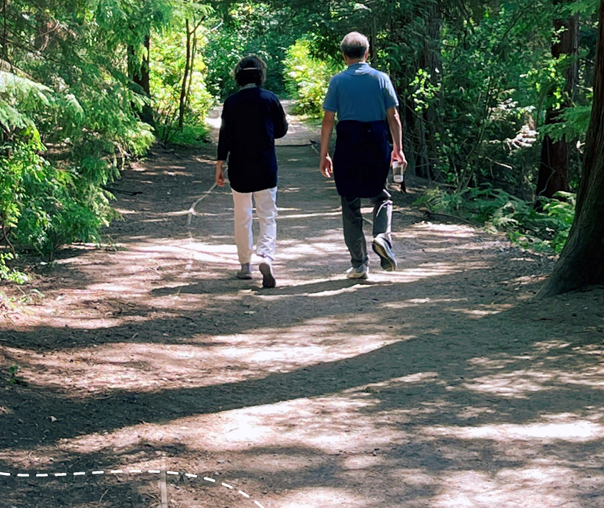
Port Moody is making bold strides toward redefining how residents and visitors experience its renowned outdoor spaces. With more than 60 kilometres of trails already crisscrossing the city’s urban fabric and forested parks, the newly unveiled Trail Network Plan lays out an ambitious roadmap for managing, expanding, and improving this cherished community asset over the next three decades. Anchored by a vision of sustainability, accessibility, and cultural respect, the plan promises to weave trails deeper into the everyday life of Port Moody’s diverse neighbourhoods.
A Trail Plan with Purpose
As trail use in Port Moody has surged in recent years—reflecting broader regional trends toward active transportation and outdoor recreation—the City recognized the need for a coordinated response. The Trail Network Plan was created to meet that demand, providing a guiding framework that prioritizes user experience, environmental stewardship, and long-term sustainability.
This isn’t just about leisure walks or scenic jogs. The trail network also plays a vital role in the city’s broader transportation strategy, offering residents alternatives to car travel and creating safe, scenic routes to schools, parks, transit, and town centres.
The Plan focuses on trails managed by the City of Port Moody and the Tri-Cities Off Road Cycling Association (TORCA), excluding those in adjacent municipalities or Belcarra Regional Park.
Core Values and Guiding Vision
At the heart of the plan is a community-informed vision:
“Port Moody’s trail network provides residents and visitors with recreational opportunities and connections to enjoy Port Moody’s natural areas and community spaces through active transportation.”
This vision is brought to life through five guiding principles:
Make trails accessible to all.
Enhance community health through recreation and nature.
Integrate with active transportation to reduce car reliance.
Improve navigation with clear wayfinding.
Encourage local stewardship and cultural respect.
Four Goals, 54 Actions
To realize this vision, the Trail Network Plan outlines four overarching goals supported by 54 concrete actions:
1. Elevate the Trail Experience
Enhancements will focus on trail amenities and maintenance, ensuring a high-quality experience for a range of users—hikers, cyclists, families, and commuters alike.
2. Connect Every Corner of the City
By expanding and linking trails throughout urban and green spaces, the plan aims to knit together neighbourhoods like Glenayre, Seaview, and College Park with key destinations such as Moody Centre, Burnaby Mountain, and Coquitlam’s network.
3. Respect and Protect Sensitive Areas
From ecological zones to culturally significant First Nations sites, protection is embedded into the trail planning process through environmental assessments and collaboration with Indigenous communities.
4. Foster Trail Stewardship
By renewing partnerships, especially with TORCA, and promoting community programs, the city is doubling down on shared responsibility for its trail infrastructure.
Highlights from the Action Plan
Several core actions stand out for their transformative potential:
Expanding trail coverage in under-served areas and improving urban multi-use paths.
Making trails more accessible, especially for people with mobility challenges.
Formalizing existing informal trails and ensuring all new builds undergo environmental scrutiny.
Enhancing cultural recognition, including signage and trail names reflecting First Nations heritage.
Renewing TORCA’s stewardship agreement to maintain new mountain bike-focused trails.
Proposed Trail Extensions: Bridging Gaps, Opening Access
Among the most exciting features of the draft plan are proposed network extensions:
New trails in Chines Park and an extension of the Shoreline Trail.
Green links connecting Old Orchard Park to Bert Flinn Park and Chines Park to Rocky Point.
Improved urban routes for bike and pedestrian access from Glenayre to Burnaby Mountain and beyond.
Regional greenways, including new connections between Pleasantside and Belcarra.
These proposed additions will be subject to feasibility studies, funding availability, and environmental assessments—but they reflect a clear ambition to make nature and recreation more accessible citywide.
Listening to the Community
Port Moody’s planning process has been shaped by extensive public engagement, beginning in spring 2023 and continuing into early 2025. Highlights include:
Trailhead pop-ups and online surveys in fall 2023.
A dedicated Youth Open House in May 2024 to capture young residents’ voices.
A second engagement phase in late 2024 focused on refining the draft plan.
Feedback collected through these initiatives directly informed the plan’s priorities and proposed actions.
Building on a Foundation of Strategic Planning
This Trail Network Plan aligns with several of Port Moody’s broader citywide frameworks, including the Official Community Plan (2014), Master Transportation Plan (2017), and Climate Action Plan (2020). It also furthers goals from the Parks and Recreation Master Plan (2015), especially those related to health, nature, and accessibility.
Looking Ahead
As Port Moody looks to the future, the Trail Network Plan represents more than just a blueprint for new routes—it’s a commitment to environmental harmony, cultural respect, and community well-being. With finalization expected in early 2025, residents can look forward to a more connected, accessible, and sustainable city.
Curious how this could shape your neighbourhood’s trails or impact your commute? We’re tracking updates like this closely—because informed locals make the most of where they live.
Comments:
Post Your Comment: